
26 - 50 of 76110 results
| Item | Title | Type | Unique ID | Kinsman | Kinsman Kind | Family | Ethnicity | Mention Type | Category | Date | YMD | Warnings | Manuscript ID | Place Event | Place Vital | Source 1 | Source ID 1 | Alias | Link 1 | |
|---|---|---|---|---|---|---|---|---|---|---|---|---|---|---|---|---|---|---|---|---|
| 400239 | [John Green] / after Thomas Johnston / Thomas Kitchin (engraver), A PLAN of Kennebek & Sagadahok Rivers, with the adjacent Coasts: taken from Actual Surveys and dedicated to his Excely. William Shirley Esq. Governor of Massachusetts Bay Prov: in New England by Thomas Johnston, 1754 to which is added a draught of the River LaChaudiere by a French Deserter the same Year. London: Andrew Millar, May 14th 1755. |
| 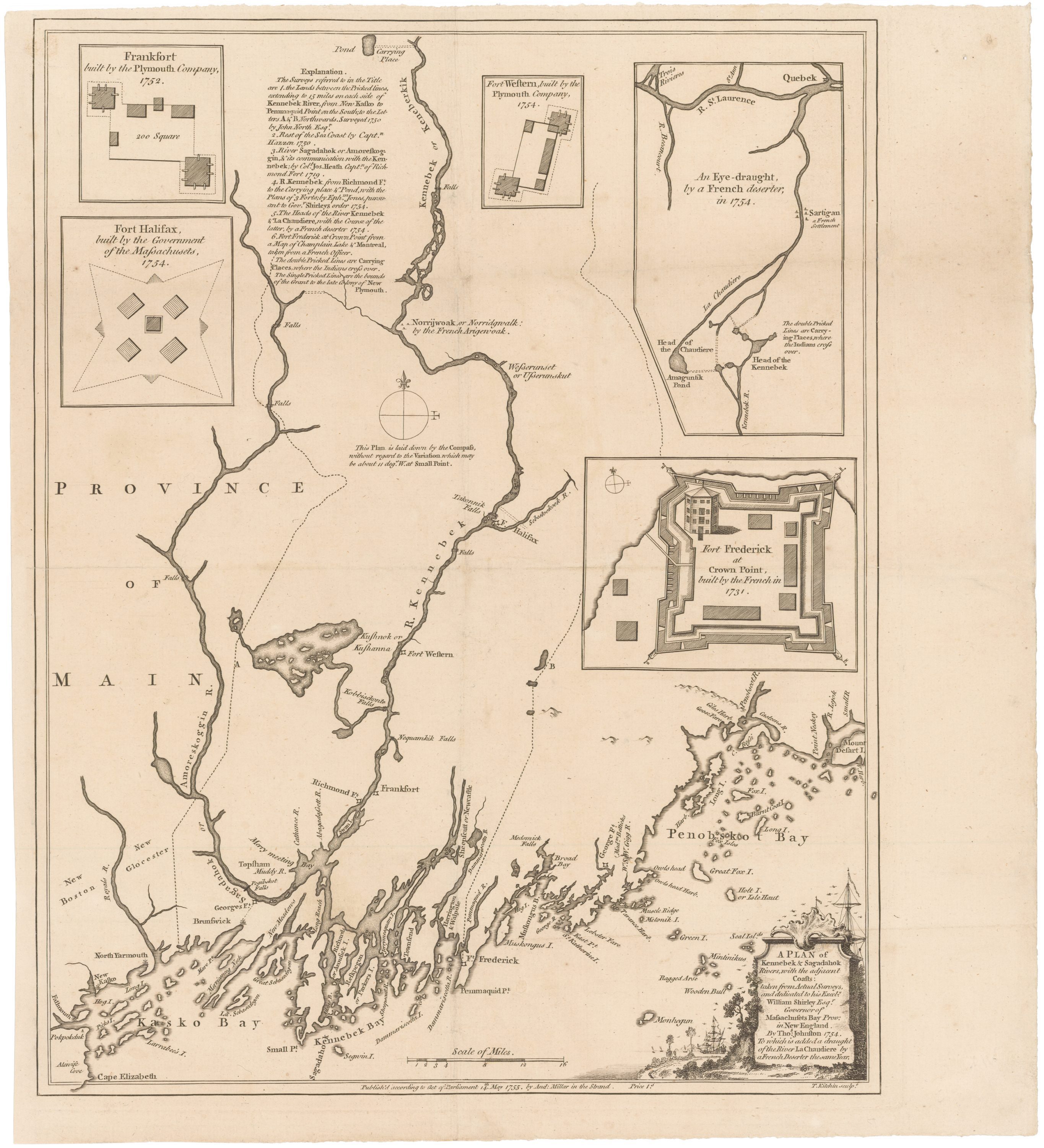
Description: Insets on the map show Fort St. Frederic at Crown Point on Lake Champlain, and Maine forts at Frankfort (Dresden), Fort Western in Augusta, and Fort Halifax in Winslow. Another shows the portage route between the headwaters of the Kennebec and Chaudiere Rivers, the main route of travel between New England and Quebec. | |||||||||||||||||
| 57188 | [unconfirmed] |
|
|
|
|
|
|
|
|
| ||||||||||
| 217144 | [Unknown] Pierre [1809] : Wife of Pierre Bernard Pomenville |
|
|
|
|
| ||||||||||||||
| 24719 | $2.58 for trap rental. |
|
|
|
|
|
|
|
| |||||||||||
| 48499 | $5.40 balance and interest. |
|
|
|
|
|
|
|
| |||||||||||
| 17447 | 1 souls; 1 man; 0:18 bu corn; 1.5# pork; 3# flour; Jo Crows Squaw. [1818] |
|
|
|
|
|
|
|
|
|
|
| ||||||||
| 39035 | 1 year old. [1859] |
|
|
|
|
|
|
|
|
| ||||||||||
| 57529 | 10 in family, 5 blankets |
|
|
|
|
|
|
|
| |||||||||||
| 38585 | 10 pounds offered for him dead or alive. |
|
|
|
|
|
|
| ||||||||||||
| 57355 | 10 years old, disabled [1849] |
|
|
|
|
|
|
|
|
| ||||||||||
| 39299 | 100 acres to be laid out for him and eldest Nanamacuck near Groton, including his faher's planting ground. |
|
|
|
|
|
|
|
|
| ||||||||||
| 44687 | 100 acres to be laid out for him and eldest Nanamacuck near Groton, including his planting ground. |
|
|
|
|
|
|
|
| |||||||||||
| 57315 | 12 years old, orphan. [1848] |
|
|
|
|
|
|
|
|
| ||||||||||
| 39469 | 13 years old. [1708] |
|
|
|
|
|
|
|
|
|
|
| ||||||||
| 57347 | 16 years old. [1882} |
|
|
|
|
|
|
|
|
|
|
| ||||||||
| 400189 | 1629 Seal of Massachusetts |
| 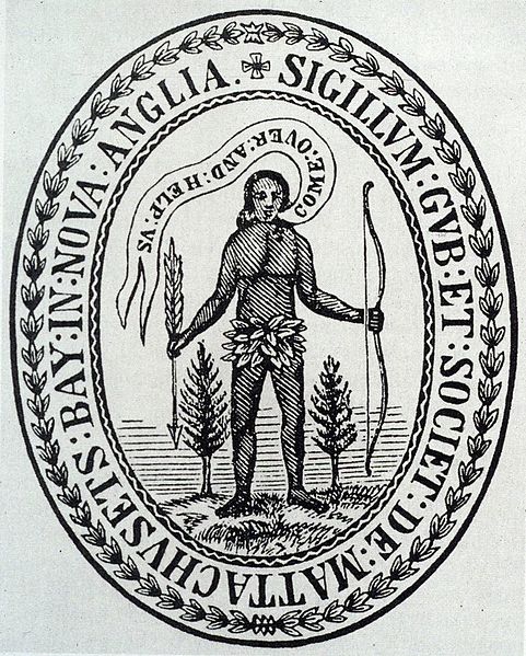
Description: Historian Nathaniel Shurtleff (922:284-5) attributes the design of this seal to John Foster, Harvard class of 1667. | |||||||||||||||||
| 400251 | 1636 Indian deed to Agawam (Springfield, MA). Courtesy of the Pioneer Valley History Network. |
| 
Description: The grantors reserved their planting grounds and rights to fishing and nut harvesting as well as the receipt of damages for crops spoiled by the settler's cattle. | |||||||||||||||||
| 18794 | 1640-80, sagamore on west side Kennebec River, son Wenunguishet/Absalom. |
|
|
|
|
|
|
|
|
| ||||||||||
| 400882 | 1680 deed to land in Marlborough, MA. Courtesy of the Marlborough Historical Society |
|
| |||||||||||||||||
| 135727 | 1680 deed to land in Marlborough, MA. Courtesy of the Marlborough Historical Society |
|
| 
Description: Natick deed for land to found Marlborough, MA | ||||||||||||||||
| 135728 | 1680 deed to land upon which Marlborough, MA was founded Courtesy of the Marlborough Historical Society |
|
| |||||||||||||||||
| 45467 | 1683-5, at Sillery & Saint Francois de Sales. |
|
|
|
|
|
|
|
| |||||||||||
| 400265 | 1684 Indian deed to Marblehead. Courtesy of the Marblehead Historical Commission. |
| 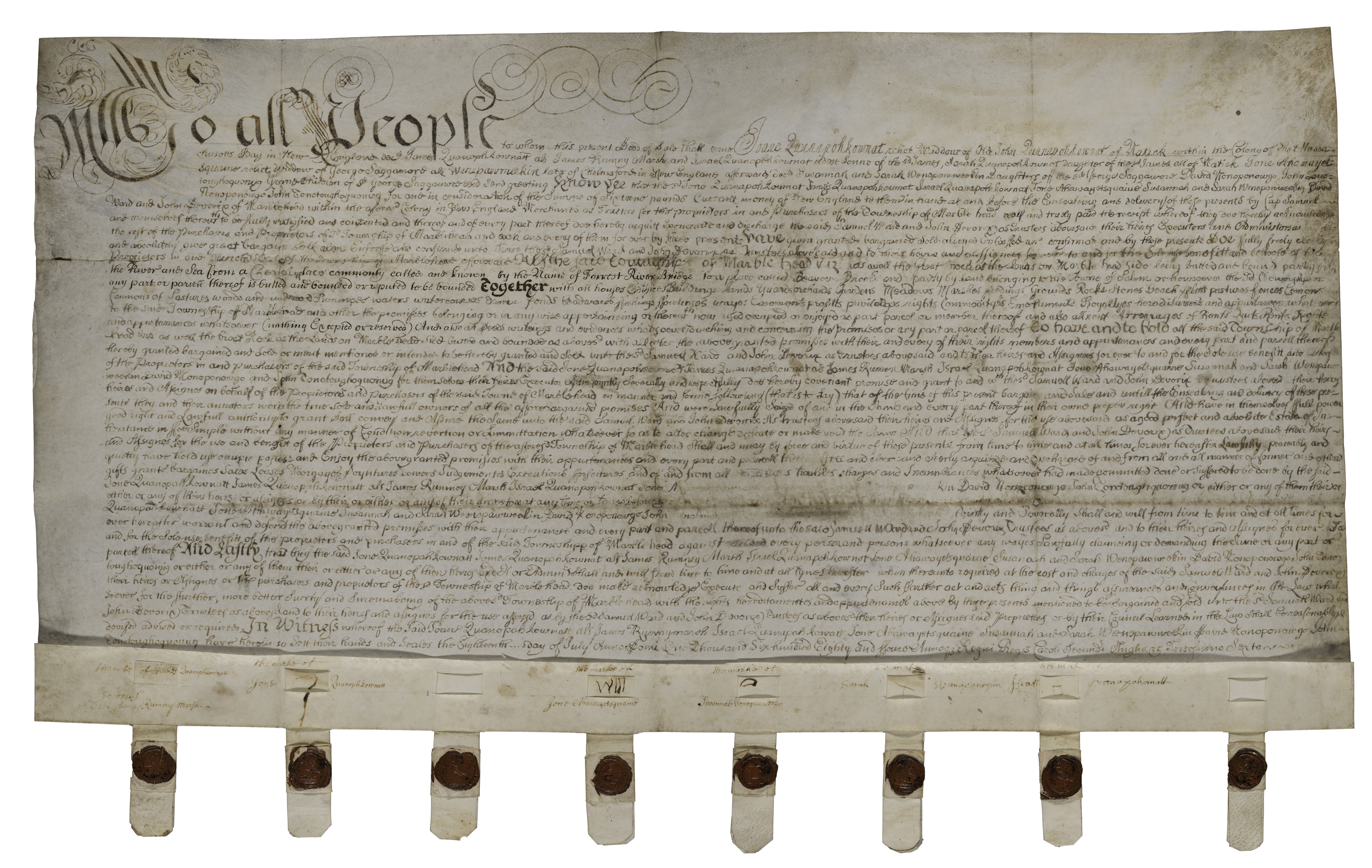
Description: Marblehead separated from Salem and incorporated as a separate town in 1649. Like the 1684 Indian deed to Boston, this deed was executed after King Charles II revoked the charter of Massachusetts Bay, thus rendering invalid all land titles if had granted. Winepoykin agreed to the grant but died before it could be executed. The deed was signed by his heirs. | |||||||||||||||||
| 400050 | 1685 Indian deed granting title of Shawmut Neck to Massachusetts Bay Colony. |
| 
Description: This quit claim deed, sighed by Josiah Wampatuck, was likely sought by The Massachusetts Bay Colony to counter the annulment by King James II of its original 1629 charter granted by Charles I in 1628. | |||||||||||||||||
| 25234 | 1687/8, his squaw and others were abusive at B. York house. |
|
|
|
|
|
|
|




Save these search results as a PDF file