
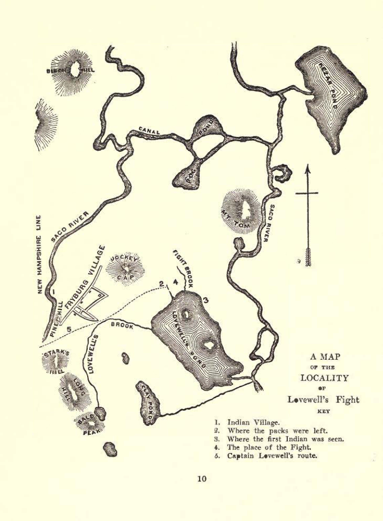
A Map of the Locality of Lovewell's Fight.
600044 
Citation
“A Map of the Locality of Lovewell's Fight.,” Historical Documents of Indians of the Far Northeast, accessed May 20, 2025, https://hrifne.avantlogic.net/digitalarchive/items/show/75453.Item600044